Plan Framework
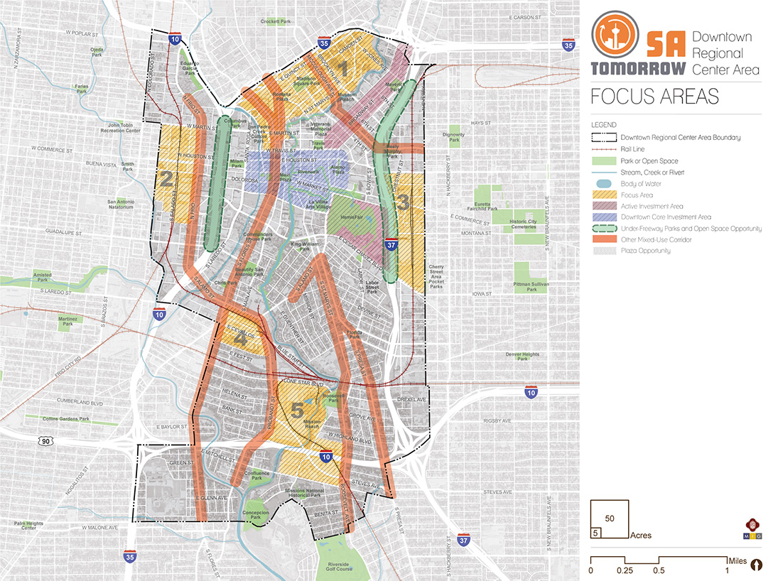
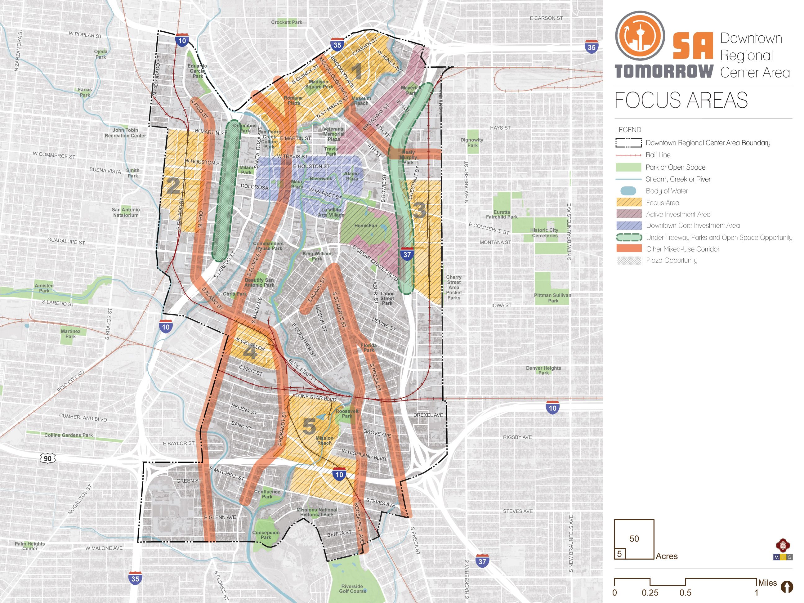
Focus Areas
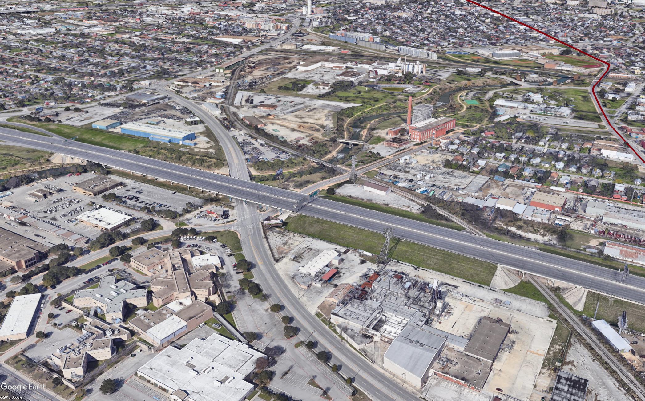
The map below highlights the Focus Areas identified for the Downtown Regional Center Area. To learn more about each of the five focus areas, click on the animated targeted circle.
Focus areas and mixed-use corridors have a strong combination of amenities and assets, where there is room for more people to live, work, and play. Focus areas may also include, or be next to, sensitive places like historic areas, creeks, major infrastructure, or traditional neighborhoods, where improvements and growth require careful planning. Each has a unique history and will have a unique future. The plan provides extra focus on these places where there are opportunities to improve quality of life in ways that will be felt by multiple generations. Focus areas and mixed-use corridors are situated throughout the Downtown Area Regional Center with the majority addressing edges of the planning area and major barriers to development and connectivity that exist today.
Recommendation #1:
Prioritize major amenity and infrastructure improvement projects that support growth in focus areas and mixed-use corridors.Recommendation #2:
Update zoning and design standards to support the unique vision for each focus area and mixed-use corridor, create high quality places, support transportation choices, and avoid impacts to sensitive areas nearby.Recommendation #3:
Implement housing and economic development programs and incentives to support focus areas and mixed-use corridors as inclusive places of housing, employment, and recreational opportunity for a diverse population.Recommendation #4:
Ensure transitions between new, higher-intensity development in focus areas and mixed-use corridors and established traditional neighborhoods.Recommendation #5:
Balance development and investment in focus areas with protection and enhancements of public spaces, including parks, plazas, waterways, and publicly accessible privately-owned gathering spaces.Recommendation #6:
Ensure focus areas, mixed-use corridors and other area amenities can be safely and comfortably accessed by all modes of travel.Focus areas and mixed-use corridors have a strong combination of amenities and assets, where there is room for more people to live, work, and play. Focus areas may also include, or be next to, sensitive places like historic areas, creeks, major infrastructure, or traditional neighborhoods, where improvements and growth require careful planning. Each has a unique history and will have a unique future. The plan provides extra focus on these places where there are opportunities to improve quality of life in ways that will be felt by multiple generations. Focus areas and mixed-use corridors are situated throughout the Downtown Area Regional Center with the majority addressing edges of the planning area and major barriers to development and connectivity that exist today.
Focus Area #1: Madison Square Park/River North

Augusta and Lexington Avenue
The Madison Square Park/River North Focus Area is located along the northern edge of the plan area, bordering the Midtown Area Regional Center and IH-35. Madison Square Park is at its center and the area includes the San Antonio Museum of Art, the Baptist Medical Center, Central Catholic and Providence Catholic Schools, and Fox Tech and CAST Tech High Schools. Part of the 2009 River North Master Plan, this Focus Area includes what that plan dubbed the Madison Square Park and Museum Neighborhoods.
While the Broadway Corridor has seen significant public and private investment in recent years, the Madison Square Park/River North Focus Area just west of the Broadway Corridor and all of its recent development activity, has lagged behind and many blocks are mostly or entirely made up of surface parking.

Madison Square Park/River North Focus Area
Vision
The Madison Square Park/River North Focus Area should be a complete neighborhood where you can live and perform daily activities like shopping, dining, and recreation. It should continue to be a concentration of institutions celebrating visual arts, performing arts and other cultural amenities, with complementary studios, craft businesses, and performance spaces in the surrounding area. Development should be of diverse styles and designed to enhance the pedestrian experience, preserving the historic street grid and resulting in streetscapes that are unique, comfortable, and enjoyable places to spend time. Development along the San Antonio River should maintain the open character of the river corridor and enhance the view from the river itself and street level vistas. Development along the edges of Madison Square Park should generally be two to eight stories tall and enhance the quality of the public space through a diverse mix of uses that activate the park and buildings that complement the design of existing anchors nearby. The most intense development in terms of density and scale should be focused in the southern end of the Focus Area and on the northern edge along IH-35.
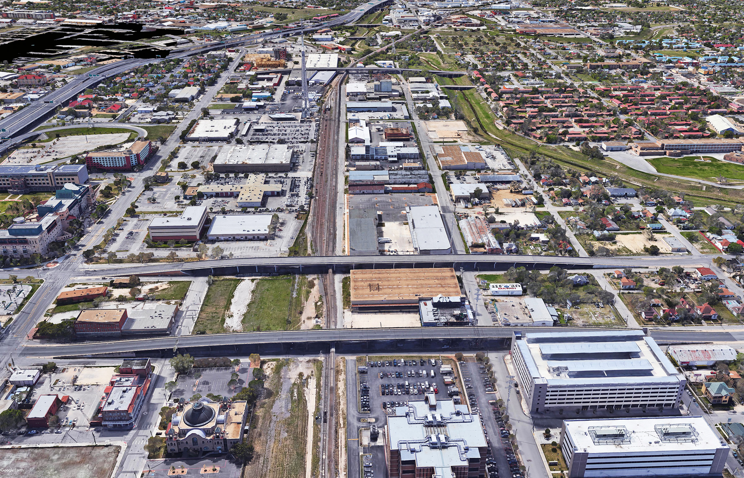
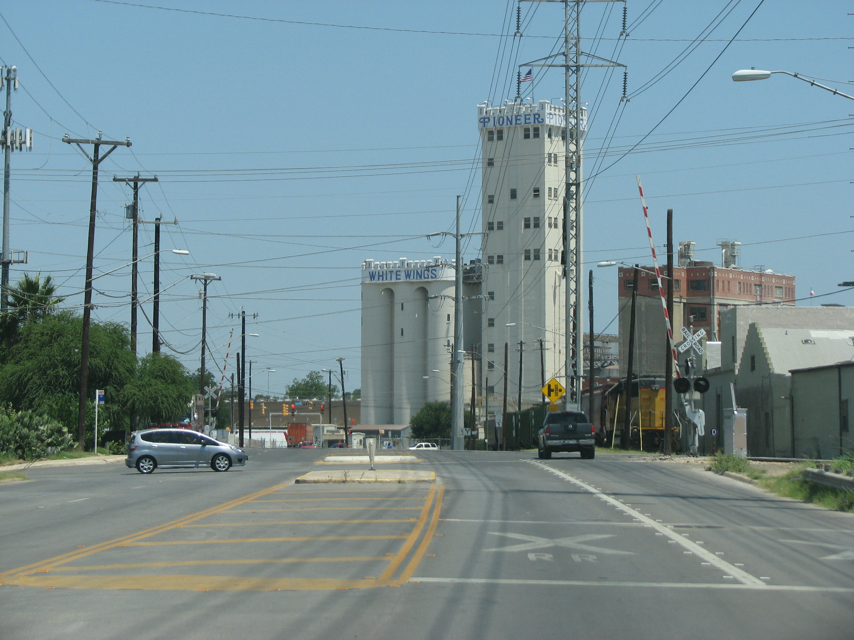
Focus Area #2: Cattleman Square/Frio Street
Comprising much of an area known as Vista Verde South, once a vibrant neighborhood with businesses, churches, schools and homes nearby the Missouri Pacific Railroad Depot (Depot), lumber and stockyards, the area suffered economic decline, decay, and disinvestment beginning with the Great Depression and continuing with the construction of IH-35 and the closure of the Depot. Situated along Frio Street between West Martin Street, San Marcos Street, and San Fernando Street, the area is divided by railroad tracks and is largely cut off from the Downtown core by IH-35. Likewise, the Focus Area is effectively separated from the Westside by Alazan Creek and has few connections westward. This area is currently home to large institutional facilities like the Bexar County Jail, Municipal Courts, the City of San Antonio Fleet Maintenance and Operations, the City of San Antonio Information Technology and Services Department, VIA Metropolitan Transit Headquarters, and numerous industrial businesses and warehouses. Many of these institutional, utility, and industrial uses occupy large sites that interrupt the street grid, further compounding mobility and access in the area.
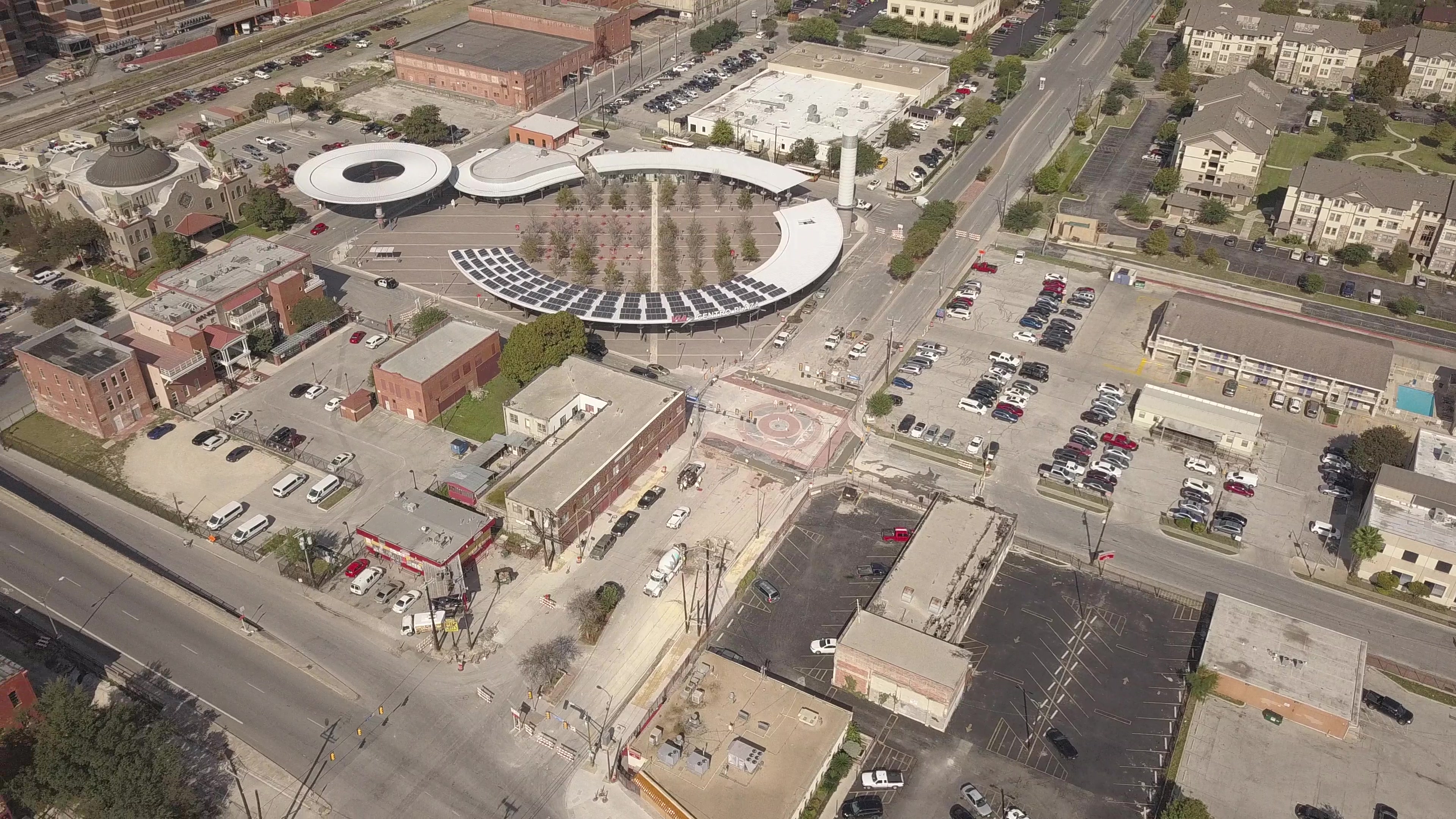
VIA's Centro Plaza & Cattleman Square Area
Cattleman Square/Frio Street Focus Area
Vision
The Cattleman Square/Frio Street Focus Area should be a walkable and sustainable neighborhood, supportive of and activated by the University of Texas at San Antonio Downtown Campus; a place of 24/7 activity. It should not only be home to students, educators, and university staff, but a home to arts and cultural institutions, their administrations and supporting businesses. Future development should serve to sustain and strengthen not just the physical, but also the emotional connections with the area's historic and cultural legacy by preserving and restoring the historic street grid to the greatest possible extent, spanning the barriers created by the creek, railroad tracks, Frio Street, and IH-35, and reestablishing connections between the Westside and the Downtown core. Streetscapes should be safe for pedestrians and people riding bicycles, with comfortable sidewalks, good lighting, shade, dedicated bike facilities, and other amenities, along with street and railroad crossings that are safe for all users.
New buildings may be up to ten stories tall along Frio Street near Buena Vista Street and Commerce Street. However, most new development should be much smaller in scale, with mid-rise buildings decreasing in scale to one or two story buildings from east to west to respect the transition to traditional neighborhoods to the west. The University of Texas at San Antonio Downtown Campus will expand to add new buildings for education, research, administration, and student housing. West of the railroad tracks businesses and small scale industry are interspersed with live/work spaces, apartments, artists' studios, shops and services. Enhanced transit service increases the mobility and access available to the area's residents, workers, and visitors. The perimeter walls of the Bexar County Jail are transformed by art expressing the legacy of the community and reducing the impact of the facility on the surrounding area. In the distant future, the railroad tracks are consolidated and diverted below ground to be covered by greens, parks, and community gathering places.
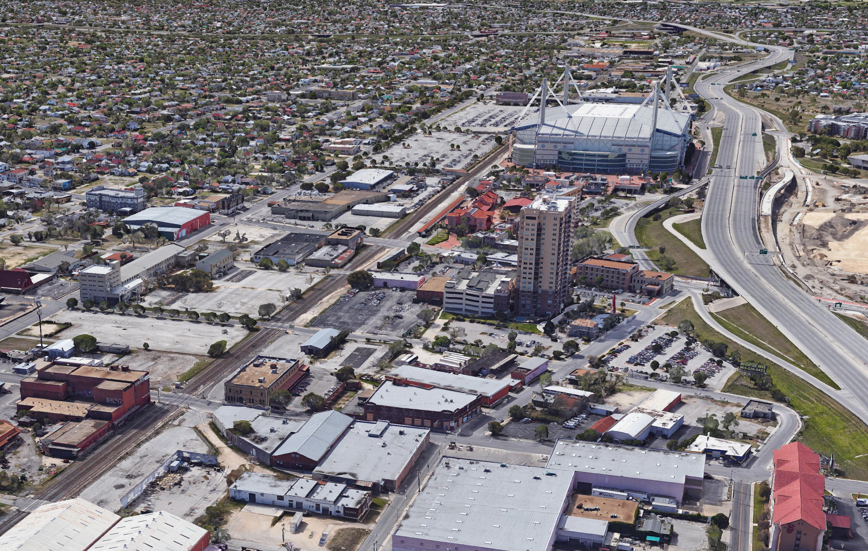
Focus Area #3: Alamodome/St. Paul Square
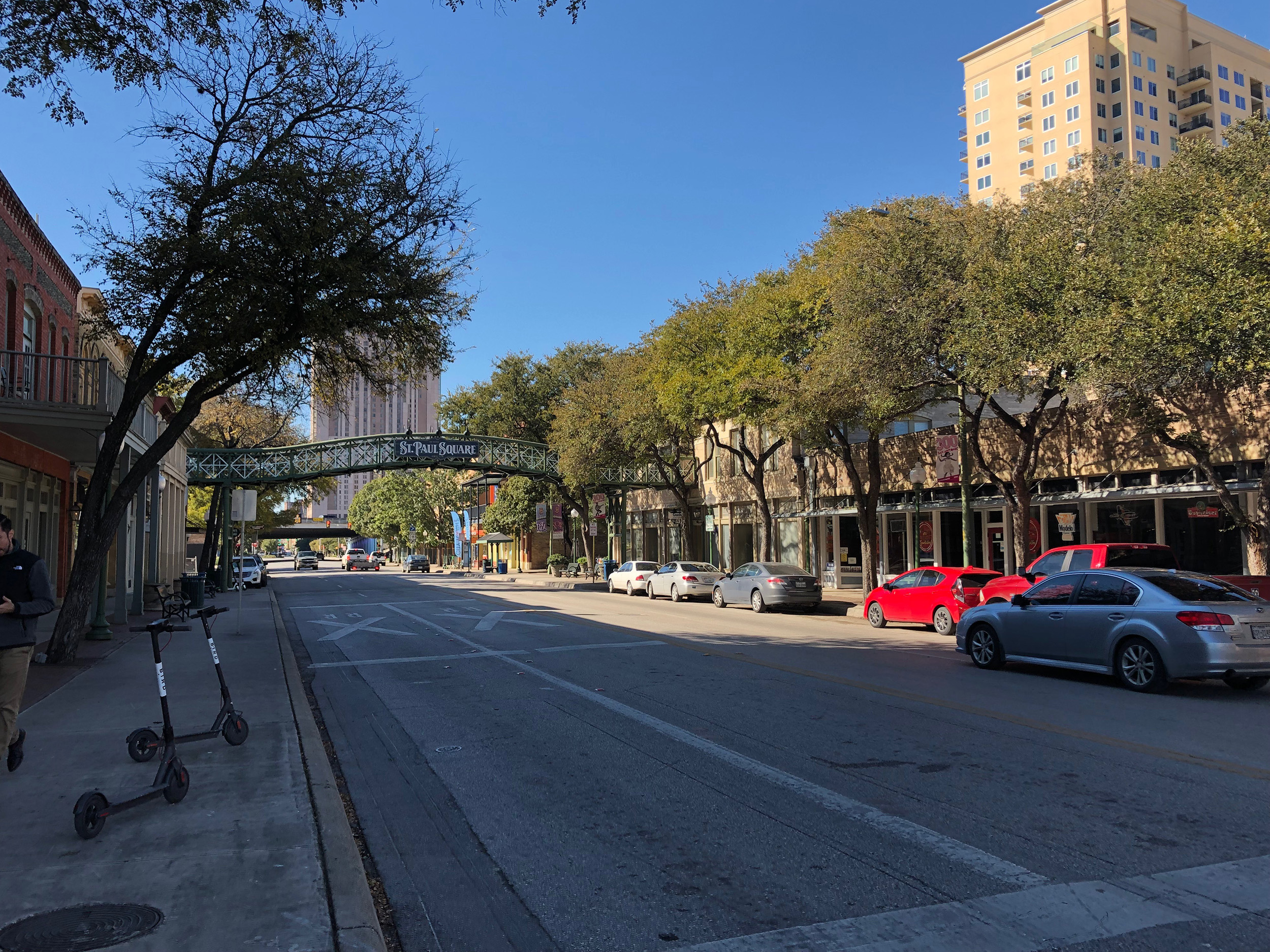
St. Paul Square
The Alamodome/St. Paul Square Focus Area is situated in the area south of Houston Street, north of Cesar Chavez Boulevard, east of IH-37, and west of Cherry Street, and is bisected by the Union Pacific Railroad tracks. It is largely an area of commercial and industrial land uses interspersed with hotels and a few recently built multi-family developments; however, its most prominent feature is the city-owned Alamodome arena and its associated parking lots. Other prominent features include the Healy-Murphy Center and Healy-Murphy Park, Sunset Station, and the St. Paul Square Historic District.
The Alamodome/St. Paul Square Focus Area is both a barrier and a potential gateway between Downtown and the Near Eastside, with numerous at-grade railroad crossings and monolithic industrial and institutional land uses combined with poor sidewalk conditions and IH-37 to create a place that is poorly suited to pedestrians. Cherry Street—the eastern extent of the Downtown Area Regional Center plan and this Focus Area—is a transition point between large-scale development and traditional neighborhoods to the east.
Alamodome/St. Paul Square Focus Area
Vision
The vision for the Alamodome/St. Paul Square Focus Area is for a safe, walkable, and vibrant mixed-use neighborhood that connects the Eastside and Downtown. It should have a mixed-use fabric woven of multiple types of housing, neighborhood-scaled commercial spaces to serve the daily needs of its residents, and music and entertainment venues creating around the clock activity. Streetscapes should be safe, comfortable, and functional places that move people biking, walking, driving, and using transit.
Development should be mid-rise in scale, generally between four and six stories, decreasing in height and massing from west to east to respect the transition from large-scale downtown development to smaller-scale traditional neighborhoods marking the western edge of the Eastside Community Area. The tallest buildings and highest density of people should be adjacent to VIA’s planned East-West rapid transit corridor along Commerce Street to support the public’s investment and ensure that the greatest number of people have easy access to this amenity in the future. Small plazas and pocket parks will create gathering places for residents and visitors and humanize the urban environment. Catalytic Site Concepts for the Alamodome Parking Lots illustrate what the area might look like in the future.
Focus Area #4: East Cevallos
The East Cevallos Focus Area is centered on East Cevallos Street and is located between South Flores Street, South Alamo Street, Simon Street, and Probandt Street. Unlike the other focus areas, East Cevallos has already experienced substantial growth in recent years with new apartments, businesses, and single-family homes replacing vacant and former industrial land and buildings. An area north of Clay Street situated along the railroad tracks was once warehouses and businesses and has seen apartments and mixed-use buildings developed and planned. South of Clay Street is a largely single-family neighborhood with a mix of modest traditional homes and recent modern single-family infill development bound on the north, east, and west by major arterial roadways. This Focus Area has limited options for north-south travel within the neighborhood and the surrounding roadways are lacking in pedestrian and bicycle amenities, let alone shaded sidewalks and separated bike lanes. Exacerbating the problem, moderately compact infill development has resulted in an increase in demand for on-street parking on narrow neighborhood streets, often with narrow, discontinuous, or no sidewalks.

East Cevallos Focus Area
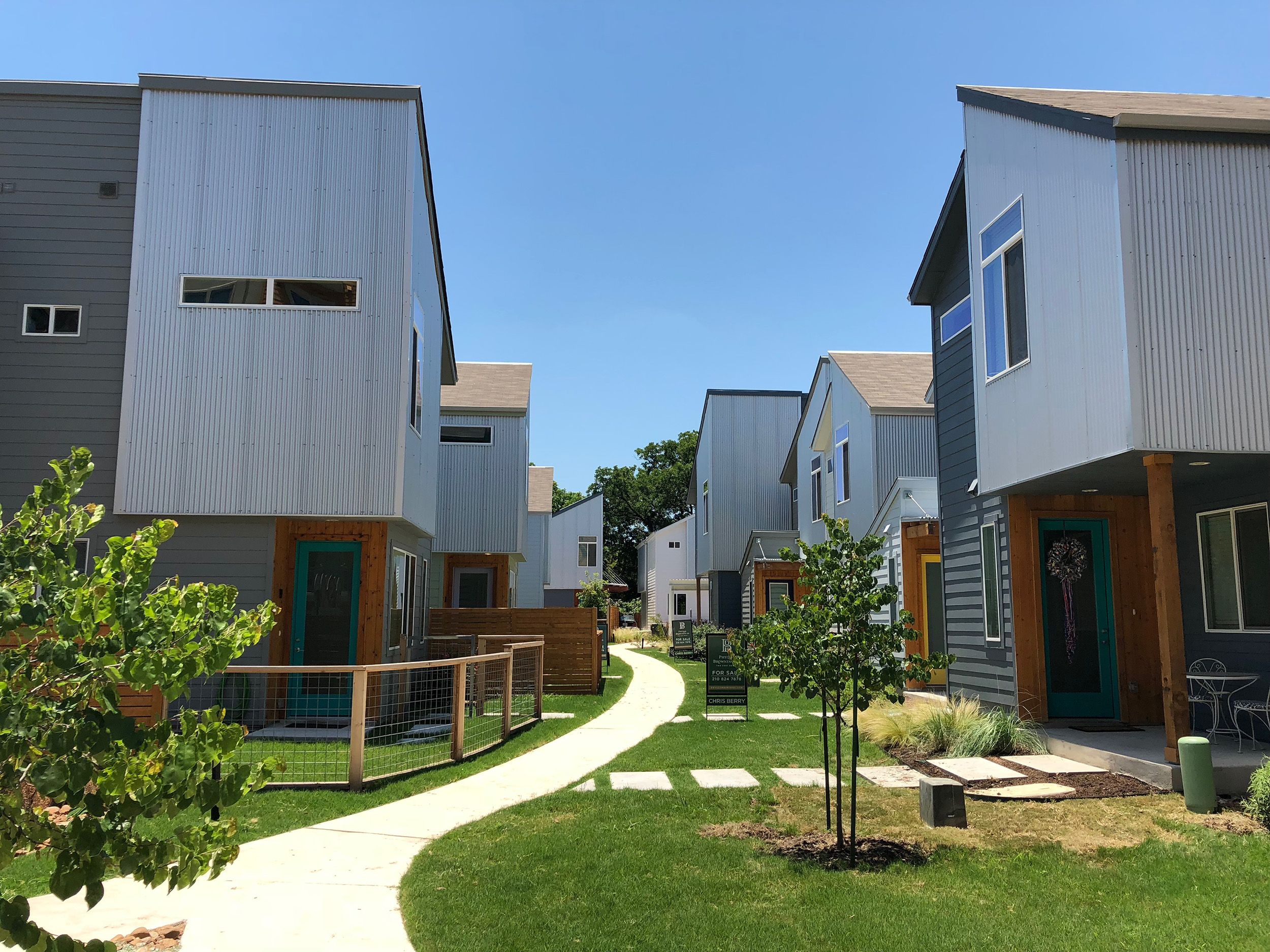
New Homes in the East Cevallos Focus Area
Vision
The vision for East Cevallos is an area with a legible multimodal transportation network and well-defined roads that provide dedicated pedestrian spaces and bike facilities that are safe, comfortable, and enjoyable. Street and railroad crossings will be safe for all users and streetscapes will be well lit in the evenings and well landscaped to provide traffic calming, urban cooling, and shade.
Development will create a mix of commercial areas near and among residential areas with a range of densities and forms, with the greatest concentrations of people living along higher intensity, mixed-use arterial roadways along the “edges” of the Focus Area and continuing along Cevallos Street. New buildings should be between one and five stores tall with the majority being three to five stories. Buildings as tall as seven or eight stories are appropriate north of Cevallos Street or along Probandt Street.
Focus Area #5: Lone Star
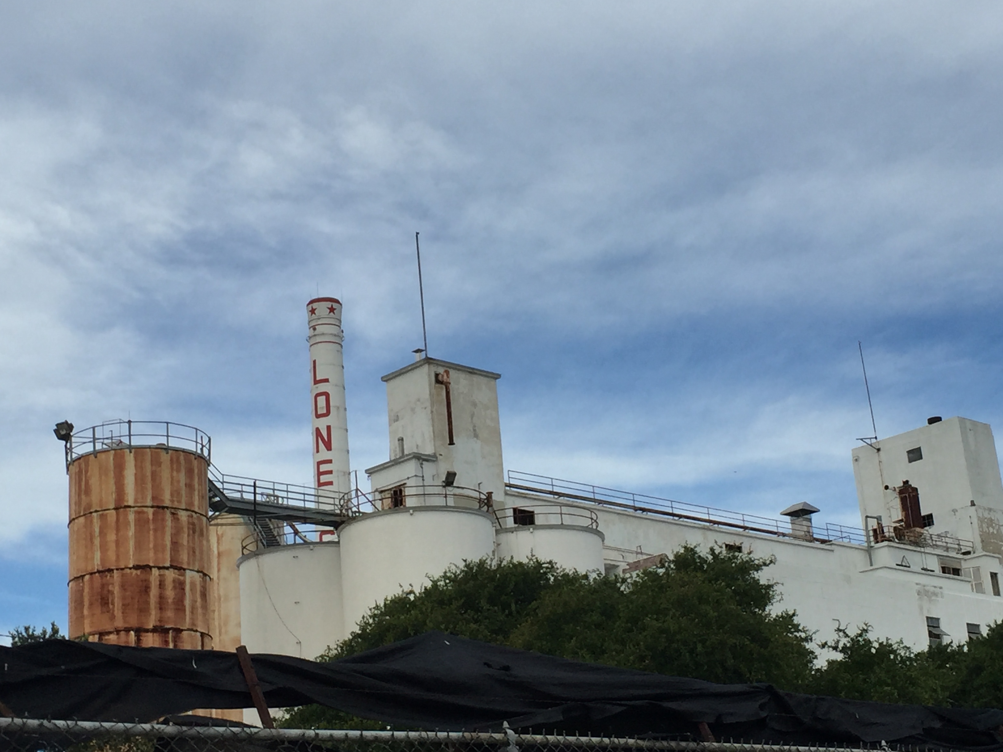
Lone Star Brewery
The Lone Star Focus Area is centered on the Mission Reach of the San Antonio River and includes the former Lone Star Brewery site, as well as adjacent institutional and industrial sites between Probant Street and Roosevelt Avenue, south of Lone Star Boulevard and north of Mitchell Street. This Focus Area also includes the EPIcenter (Energy Partnerships Innovation Center) incubator and Bexar County Juvenile Detention Center. Most of the area consists of current or former heavy industrial land uses and it is crossed by an active railroad line.
Lone Star Focus Area
Vision
The Lone Star Focus Area should be a family-friendly, sustainable, and diverse mixed-use center serving both current nearby residents as well as new residents living within new mixed-use developments. It should be a place where residents can shop, buy groceries, work, and find entertainment. New multi-family residences will provide housing opportunities for a variety of household types, sizes, and incomes, and give people the opportunity to live near their place of work. This Focus Area should build off the foundation created by EPIcenter to become a center for creative and innovative businesses.
As formerly industrial spaces are redeveloped, the new development should preserve elements of the industrial feel and create a connection to the area’s industrial heritage through the reuse of older industrial buildings and infrastructure. New development and redeveloped sites should be well connected to the river through pedestrian-oriented streetscapes with wide sidewalks, shade, safe crossings, and other amenities. Additionally, this Focus Area is located within the River Improvement Overlay District (RIO-4), allowing new buildings on larger development sites up to ten stories tall (if located within a Development Node as described by section 35-338 of the Unified Development Code), although most buildings will be substantially shorter in the one to five story range.
Mixed-use Corridors
Flores Street Mixed-use Corridor
Flores Street traverses the entire Downtown Area Regional Center from north to south and changes character several times along its extent. At the northern end, much of the land on either side is vacant or surface parking with landmarks like Fox Tech High School and ArtPace, and other buildings often only a few stories tall. Between Martin Street and Cesar Chavez Boulevard, Flores Street is a Downtown core thoroughfare with a diverse mix of uses in taller buildings, wider sidewalks, few curb cuts, and lots of activity. South of Cesar Chavez Boulevard to Cevallos Street, tall downtown buildings give way to more land intensive commercial, industrial, and institutional sites interspersed with apartments and condominiums along with the occasional mixed-use building. Redevelopment of historic commercial buildings as mixed-use buildings and condominiums has begun to generate new levels of activity on this section of the corridor, however the sidewalks are narrow in this segment of Downtown and there is little in the way of landscaping along the street to create a desirable pedestrian environment. South of Cevallos Street, Flores Street serves as a neighborhood main street lined with small commercial buildings, churches, and schools behind which are traditional single-family homes.
South Flores Street
Vision
Flores Street should continue as a mixed-use corridor as new development increases the number of people living and working along it. New buildings should both respect and inform their context along the corridor, with tall buildings appropriate to the Downtown core located north of Cesar Chavez Boulevard, transitioning to mid-rise buildings (from two to six stories tall) between Cesar Chavez Boulevard and Cevallos Street, and one to three story buildings from there continuing south. As more people come to use these areas, sidewalks, bicycle facilities, and other aspects of the streetscape will need to be improved.
Frio Street Mixed-use Corridor
Frio Street north of IH-35/IH-10 includes a mix of institutional and commercial land uses, as well as pockets of single-family homes at the southern end, and several large apartment complexes at the northern end. Aside from recent improvements near the University of Texas at San Antonio, Frio Street is fairly wide, allowing traffic to move quickly. However, most sidewalks are narrow and marked pedestrian crossings are few and far between, leading to an automobile dominated streetscape that is unsafe and uncomfortable to other ways of getting around. The corridor is part of the Vista Verde South neighborhood and Cattleman’s Square Historic District.
Vision
New development along Frio Street should strengthen ties to the cultural resources and legacy of the community by restoring connections between the east and west sides of the corridor with safe and comfortable streetscapes and street crossings and gathering places that allow people to experience the cultural landscape and identity of the area. More people can and should be able to live, work, and gather along and near to Frio Street. Per the direction provided for the adjoining focus area, new buildings may be up to ten stories tall along Frio Street near Buena Vista Street and Commerce Street. However, most new development should be much smaller in scale, with mid-rise buildings decreasing in scale to one or two story buildings from east to west to respect the transition to traditional neighborhoods to the west.
South Alamo Street & Probandt Street Mixed-use Corridor
Probandt Street
South Alamo Street from IH-35/IH-10 to Probandt Street and continuing south along Probandt Street is a wide, automobile-oriented corridor that move cars quickly through the area, but does not accommodate other modes of travel very well. The availability of sidewalks is inconsistent and where present, sidewalks are mostly in poor condition, narrow, and lacking pedestrian amenities. Recent infill development has improved sidewalk conditions in a piecemeal manner, so gaps are now even more pronounced. This corridor includes a mix of older commercial buildings interspersed with large industrial sites. Along the southern segment, south of Lone Star Boulevard, single-family homes front the west side of Probandt Street and mix with several commercial buildings and restaurants. The east side of this portion of the corridor is the Lone Star Focus Area described earlier. This corridor is impacted by two at-grade railroad crossings at Probandt and East Cevallos Street and at Probandt and Lone Star Boulevard.
Vision
The vision for this corridor is of a bustling mixed-use corridor with new places for people to live, work, shop, and gather. Commercial diversity brings new places to eat, shop, celebrate, and find everyday services. The amount of right-of-way devoted to moving automobiles along South Alamo and Probandt streets should be reduced to calm traffic and to accommodate the addition of separated bike lanes, wide and shaded sidewalks that are comfortable and inviting, and safer crossing conditions both at street intersections and railroad crossings. The corridor plays an important role, along with the Frio Street corridor, of connecting three focus areas, including Cattleman’s Square/Frio Street, East Cevallos, and Lone Star. Both portions of the corridor should include a wide variety of uses with the highest intensity of development and the greatest concentration of entertainment and commercial uses directly adjacent to the corridor, particularly in and adjacent to the focus areas.
South St. Mary’s Street & Roosevelt Avenue Mixed-use Corridor
South St. Mary’s Street from South Alamo Street to the railroad tracks and continuing south as Roosevelt Avenue has a mix of dining and drinking establishments, as well as shops and services, schools, churches, and parks in a fairly compact, traditional main street form. Many historic commercial and residential buildings continue to be actively used and many have been restored and reused several times. This area is part of the historic King William, Lavaca, and Roosevelt Park neighborhoods and connects the Downtown core with areas to the south. VIA is considering using St. Mary’s Street and Roosevelt Avenue for high quality rapid transit service.

South Alamo Street at South St. Mary’s Street
Vision
The vision for this corridor is for moderate growth in commercial business, services, and housing. Existing structures that contribute to the identity of the area should be adapted to new uses. Higher density residential infill should complement existing commercial and residential properties. A mix of additional commercial uses should support investments in rapid transit service and streetscapes should allow more people to use the corridor without relying on a car. The vision includes striking a balance of infusing more people and activity along the corridor to support transit and other amenities, while still celebrating and respecting the historic main street fabric that is very much intact along this corridor. New development should be designed to be compatible with existing buildings as prescribed by existing design standards and guidelines.
South Presa Street Mixed-use Corridor

South Presa Street Storefronts
Like South St. Mary’s Street, South Presa Street is primarily a traditional main street serving the surrounding neighborhoods. Though not as abundant as St. Mary’s Street, Presa Street has a mix of places to eat and drink, places to shop, churches, and services. However, while St. Mary’s Street is more commercial in nature, South Presa Street has a more residential character particularly in the southern segment where single-family and multi-family homes front the corridor. Several pocket parks create places for residents to gather and visitors to rest.
Vision
The vision for this corridor is for moderate growth in housing and to a lesser extent commercial business and services. Existing structures that contribute to the identity of the area should be adapted to new uses. Higher density residential development mixed with commercial uses should support investments in rapid transit service and streetscapes should allow people to walk and bike safely and comfortably along the corridor without relying on a car. New development should be designed to be compatible with existing buildings as prescribed by existing design standards and guidelines.
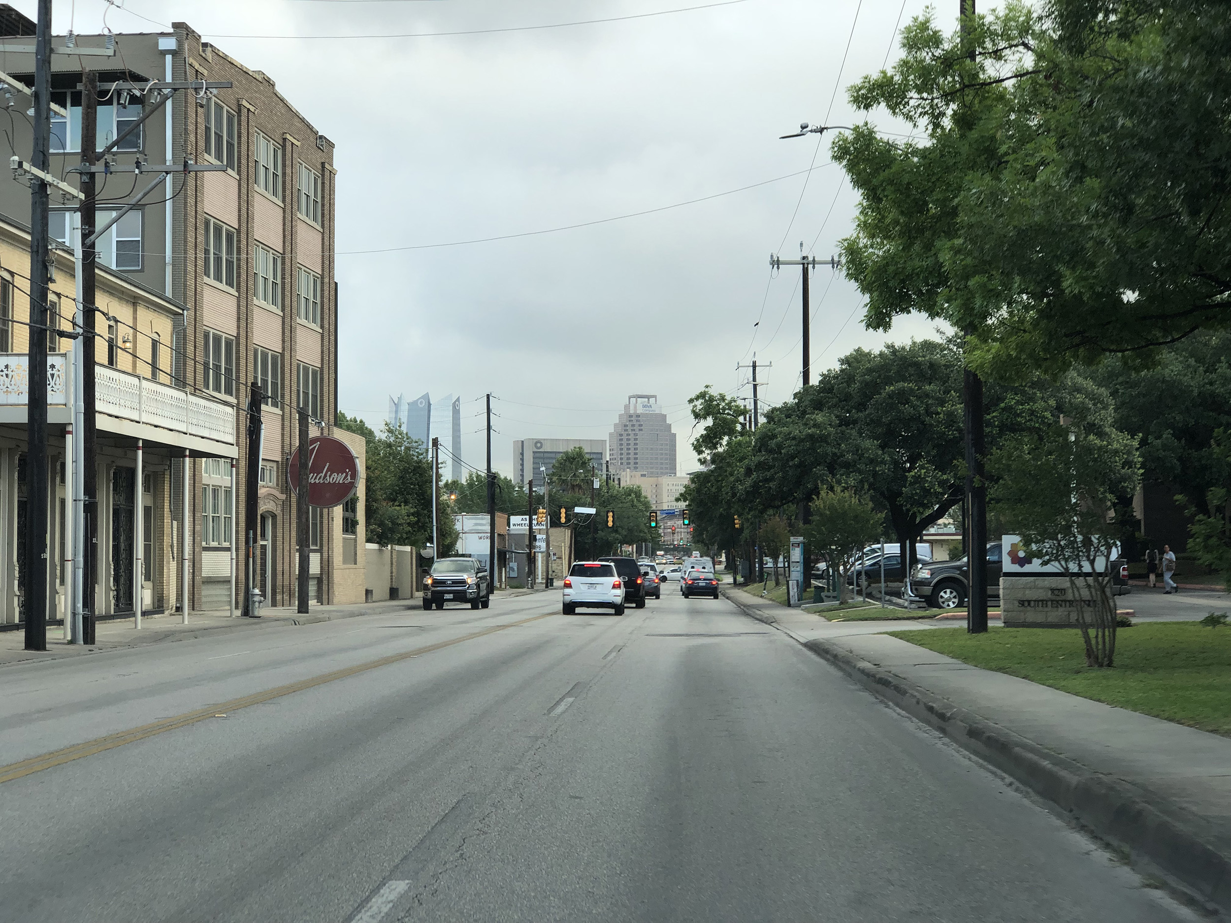
McCullough Avenue & Nolan Street Mixed-use Corridor
McCullough Avenue, continuing as Nolan Street when it crosses IH-37, crosses through the northern portion of the Downtown Area Regional Center and provides a strong opportunity for connectivity from the Midtown area through Downtown and to the Eastside. This corridor is a gateway to many Downtown churches, corporate headquarters, medical centers, the Healy–Murphy Center, and the Tobin Center for the Performing Arts. The pedestrian environment is disjointed and unwelcoming with poor lighting and uncomfortable streetscapes, and there are few places for people to live, work, or gather. The corridor is relatively non-descript today with many surface parking lots, inactive building frontages, and few pedestrian or bicycle amenities.
McCullough Avenue Existing
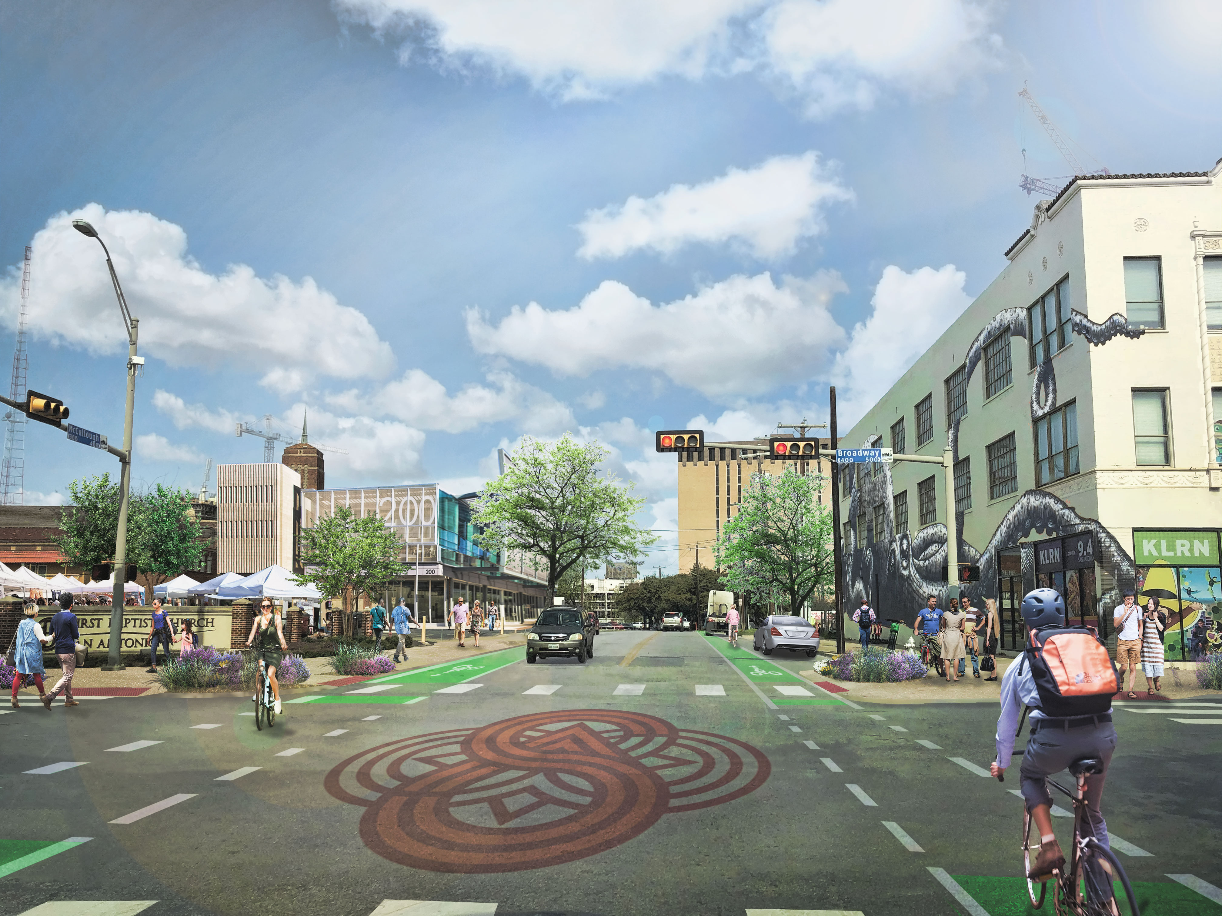
McCullough Avenue with conceptual improvements
Vision
The vision for this corridor is for a vibrant and welcoming mixed-use corridor where people live, work, and play. Inviting and engaging streetscapes encourage pedestrian activity by providing shaded sidewalks, places to sit, public art, and good pedestrian-scaled urban lighting. On-street parking creates a buffer between travel lanes and the sidewalk and bike lanes provide safe dedicated facilities for people on bicycles. The improvements to the streetscape will encourage property owners to reinvest in existing buildings and to develop lots and portions of lots that are currently vacant or devoted to surface parking.
Investment Areas
Through the planning effort, the Downtown Area Regional Center Planning Team and the community wanted to acknowledge three investment areas that are critical to the success of Downtown, but have already received a great deal of planning attention and are currently enjoying both public and private investment. With that said, the success of these investment areas is essential to the success of many of the focus areas and mixed-use corridors described in this section, as well as to the success of the overall Downtown Area Regional Center. The three investment areas include: Broadway Active Investment Area, Hemisfair Active Investment Area and the Downtown Core Investment Area.
Broadway Active Investment Area
According to the Midtown Area Regional Center Plan which also includes a significant portion of the Broadway corridor and planned 2017 Bond improvement project, Broadway should be a place for people to learn, live, work, play, and recreate outdoors. The area will play an important role in the success and character of the Broadway Cultural Corridor. This corridor begins in Downtown before extending north through Midtown and beyond. Investments include voter approved spending on design and reconstruction of Broadway to become a complete street with great transit that puts people first. Improvements in the Broadway Active Investment Area within Downtown will calm traffic, improve shade and lighting, and significantly improve the safety and comfort of crossings for all users. While private investment along the Broadway Cultural Corridor has been most evident north of Maverick Park, many projects between Maverick and Travis parks are under design or have recently broken ground. This segment of Broadway will be a critical link between the Midtown Area and the Downtown core.
HemisFair Active Investment Area
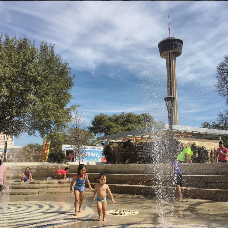
HemisFair Park Splashpad
In 2009, the San Antonio City Council established the Hemisfair Park Area Redevelopment Corporation (HPARC), a local government organization appointed to manage and revitalize the Hemisfair area. HPARC is a 501(c)3 nonprofit local government corporation that was founded on seven principles that guide all decisions in the redevelopment process of Hemisfair. These include connectivity, development, green space, balance, preservation, sustainability, and leadership. The overall mission of HPARC is to expand the existing park, and improve its quality by merging the concepts of preservation and growth.
HPARC is working to create spectacular public spaces in the heart of San Antonio, complete with plazas, courtyards, green space, art and cultural amenities, residences, and local businesses. The plan for Hemisfair will help this Downtown asset mature into a cherished community space, bursting with visitors, excitement, and functionality. Multifamily housing has recently been reintroduced to Hemisfair along with a mix of cultural and dining destinations. Future hospitality development and additional residential options at Hemisfair will continue to draw more people Downtown, both as visitors and as permanent residents.
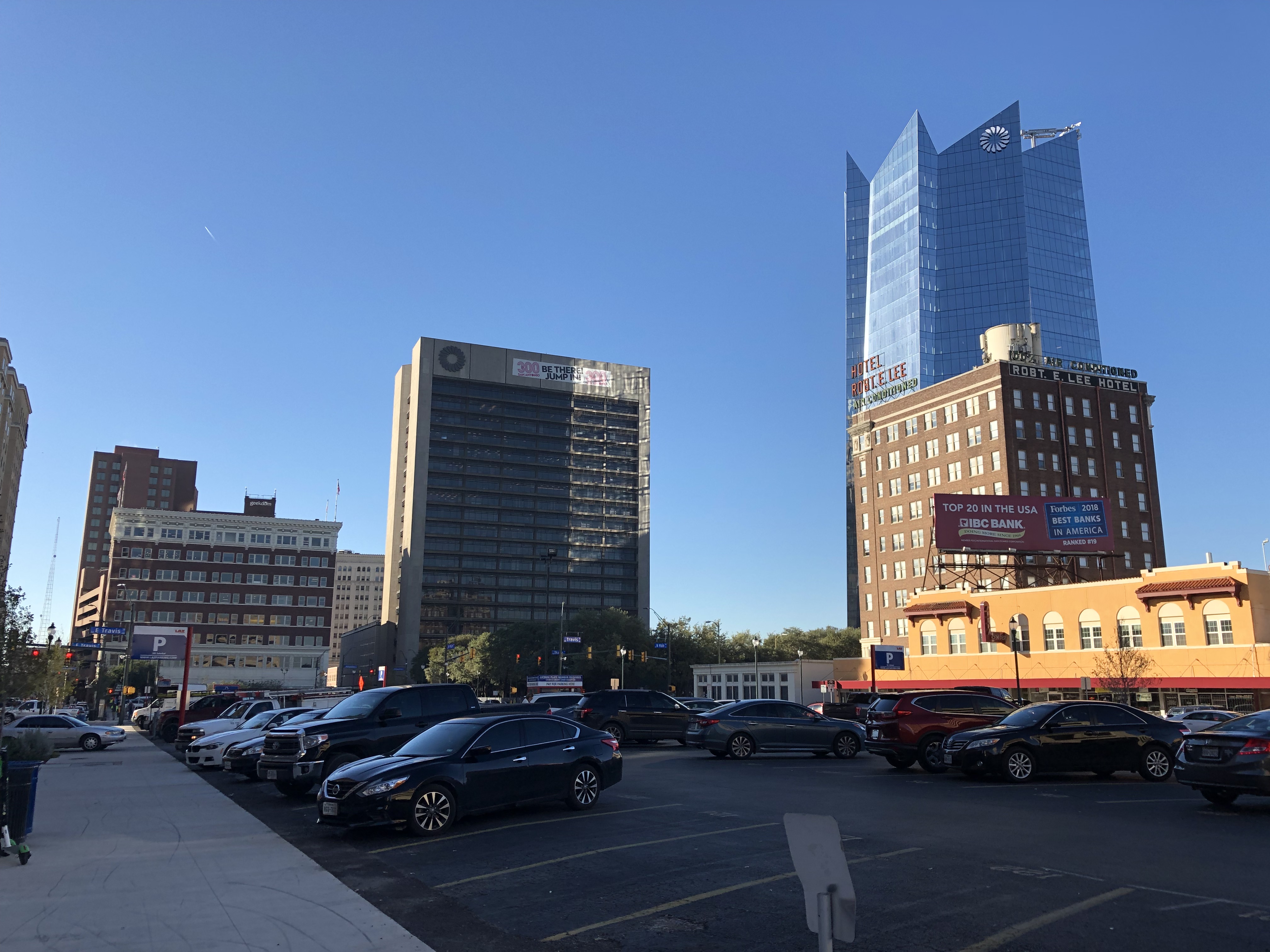
Downtown Core Investment Area
In 2010, the SA2020 effort identified the Downtown core as a major cause area. That effort said “Downtown is a showcase for visitors, a center of vibrant activity for residents to live, work and play, and an economically inviting locale for businesses to flourish. Downtown’s historic buildings and character are preserved, its parks and green spaces are inviting, and the river continues to be treasured as its defining asset.” While there are growing concerns of affordability in the Downtown Area Regional Center, and especially the Downtown core, the area is seeing significant increases in the amount of residential and commercial investment.
HemisFair has reemerged as an essential anchor to the east and the Riverwalk continues to thrive. The San Pedro Creek Culture Park and Zona Cultural investments will strengthen the western edge of the Downtown core. A major emphasis over the life of this plan will be the transition of surface and structured parking that currently dominate many portions of the Downtown core. As automobile use decreases and the Downtown core becomes an even better place to walk, bike, and utilize transit and personal mobility devices, the demand for parking will decrease and market economics will begin to support development or redevelopment of these important properties at the heart of the city. It will be important to promote a mix of uses including additional affordable, workforce, and market rate housing, offices, dining and entertainment, and hospitality.

The San Antonio River
The Downtown Core Area